Ella Rock is an iconic viewpoint outside the mountain village - turned tourist hub - of Ella. Its steep east face, from which the name is derived, sits impressively above the Ella - Wellawaya Road. In stark contrast the north side is of very different character. Rice fields, tea plantations and woody, hilly terrain provide gentle access to the hill plateau which is Ella Rock. On our recent family vacation to beautiful Sri Lanka, I was able to sneak in the widely popular hike up Ella Rock before breakfast, which is the best time of day for this little exercise.
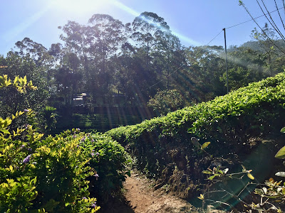
I start at our house west of town at just about 7 am through the lushly green tea plantations ...
I start at our house west of town at just about 7 am through the lushly green tea plantations ...
... up to the road into Ella, which I leave just before the tunnel to climb up to the railway tracks.
 |
| View to Ella station |
This way I don't have to take the detour via Ella station, as I now follow the railway tracks to the south with a first view of Ella Rock in the distance. The railway tracks are commonly used as footpath, ...
... but soon I have to make way for the morning train to Kandy. The trains are few and far between, go quite slowly (15 - 20 km/h) and can be heard from a distance. Nevertheless, you have to absolutely make sure to be out of the way when one approaches.
 |
| Hillside tenements of Ella |
 |
| View back to Ella |
After the Kithalella station and just about 3 km on the tracks overall, I leave the tracks to the left (in direction of travel) at this turn-off.
There are other, earlier turn-offs - some with fruit and water vendors promoting them - which you can also take, as I'd find out on the way back. However, the most easily navigable one leading to the marked trail is the one I took between mile markers 166 1/2 and 166 1/4.
 |
| Rice fields beside the railway |
Soon there is a steel bridge across a small creek, which feeds into Rawana Falls further down.
Slowly, I gain a bit of height and the views start to expand.
The main trail is constantly intersected by a network of smaller trails, ...
... which mostly all lead up to the the final, steeper section of the hike.
The trail remains well marked and technically very easy. Soon the woody plateau of Ella Rock and the viewpoint at the east end is reached.
 |
| Ella |
 |
| View to the east |
 |
| View to the south |
After snapping a couple of pictures I head to the southern end of the plateau. There is a similar, but deserted viewpoint with a little shrine ...
... at the southern end.
 |
| Steep grass at the southern end |
 |
| Mind your footing! |
 |
| View to the south |
 |
| Little Adam's Peak in the distance |
 |
| Rice fields |
... and crossing the creek down to Rawana Falls just before arriving at the railway tracks.
 |
| View back to Ella Rock from the railway tracks |
... from which I descend to the main road leading out of Ella to the west on stairs leading directly to the turn-off to our house.
I arrive to breakfast on time at 9 am.
Distance: 10 km with 484 m ascent
Overall time: 2.08 h


Keine Kommentare:
Kommentar veröffentlichen
Wenn du auf meinem Blog kommentierst, werden die von dir eingegebenen Formulardaten (und unter Umständen auch weitere personenbezogene Daten, wie z. B. deine IP-Adresse) an Google-Server übermittelt. Mehr Infos dazu findest du in meiner Datenschutzerklärung und in der Datenschutzerklärung von Google.